OTHERWISE ENGAGED…


This little Blog has been rather more neglected than usual of late while we have been away. Now back in the UK, and hoping to pay it some attention soon now that all the fun is over… Book launched, fish caught, things eaten and drunk. Reality check starts… NOW.

JACKET GRAB JPGflyer 2Birds of Abaco Verandah1900063_10152069487394482_984358031_nunnamedMahi Mahi 1

A JELLYFISH IN OXFORDSHIRE: GOOGLE SURPRISES


There are various websites revealing the weird and wonderful oddities thrown up by the Google mapping projects. Google ‘Google Map Fail’ or ‘Google Streetview Fail’ for examples, including the location of Tessa Jowell inside the Houses of Parliament, complete with directions for reaching ‘Tony Blair’ in the time of 4 hours 40 mins. tumblr_l5i5rzwhj31qa0hs6o1_500The aerial mapping project has similarly revealed amazing vast drawings in remote desert regions, viewable only from the air; jet fighters laid up in municipal car parks; and Coca Cola logos in surprising places. By chance, I found one of my own when I was looking at the topography of the Oxfordshire / Wiltshire border.

Something of interest in a field close to Ashbury?Screen Shot 2013-12-30 at 20.59.36

Zoom in – what on earth is that in the field near top centre?Ashbury 4

Mmmmm. Looks familiar, but out of place…
Screen Shot 2013-12-30 at 20.59.52

Good grief – aliens have been at work…
Screen Shot 2013-12-30 at 21.00.07

…and they plainly know all about undersea creatures on EarthAshdown jellyfish

PEAT WORKINGS, COUNTY MAYO


Between Louisburgh, Co. Mayo and Killary Harbour to the south – the boundary with Galway – is a fertile plain. This gives way to an area of wonderful high mountains and loughs, and some of the best salmon fishing in Ireland. The plain is drained by rivers, and is the perfect location for one of Ireland’s great natural resources: PEAT.

Peat Country, Co. Mayo

The backdrop to the north includes the spectacular conical pilgrimage mountain CROAGH PATRICK, rising more than 2,500 feet almost directly out of the sea. Peat workings can be seen from the main road south, but they are best viewed by taking a side road through boggy countryside to the more remote areas.

Peat Country, Louisburgh, Co Mayo 1Peat Country, Louisburgh, Co Mayo 6Peat Country, Louisburgh, Co Mayo 2Peat Country, Louisburgh, Co Mayo 5

In places the cut turf is stacked like old-fashioned corn stooks,  in gently curving rows. The effect is of some organic work that the sculptor ANTONY GORMLEY might have dreamed up.

Peat Country, Louisburgh, Co Mayo 4 Peat Country, Louisburgh, Co Mayo 3

A RIVER RUNS THROUGH IT… CERNE ABBAS, DORSET


Through and indeed under it, to be strictly accurate. This Dorset village, a few miles north of Dorchester, is well-known, but for (arguably) the wrong reason, the chalk-figure giant on the hill in all his unfeasibly impressive priapic  glory. Some say he represents Hercules (besides the fearsome club, excavations have found traces of some form of covering over the other hand – a manly lionskin for protection? Or for modesty perhaps?). Cerne Abbas, Dorset - The Cerne Giant 2

There are many theories for the giant’s origin and purpose, but the general consensus is that he dates from the c17 or early c18 – he is first noted in records in the mid-c18. Maybe he’s much older. It is said that a belief in the giant as a symbol of fertility encouraged young women of the surrounding area to climb the hill  and sit on his… oh, work it out for yourselves. Let’s move on swiftly.Cerne Abbas, Dorset - The Cerne Giant 3

The fairly recently installed car park overlooking the hill has information boards that are unusually helpful. There’s a good map of the village and its significant features, and another boards with details of the village and its history.Cerne MapCerne Abbas, Dorset - Information Board

In AD 987 a Benedictine Abbey was founded below the giant’s hill. The dissolution of the monasteries erased it, and apart from a gateway (‘Abbot’s Porch) very little remains, though lumps and bumps in a field reveal its extent. Cerne Abbas, Dorset - The Abbey Ruins FieldCerne Abbas, Dorset - Abbey NoticeCerne Abbas, Dorset - Abbey Foundation Memorial

Medieval monasteries were invariably built close to a reliable source of fresh water. The River Cerne runs through the village, with rivulets running right under the main street. It is a trout stream, which doubtless provided food for the monks. However, there was another water source that still exists. St Augustine’s Well, replete with Augustinian legend.Cerne Abbas, Dorset - St Augustine's Well LegendCerne Abbas, Dorset - St Augustin's Well

The water constantly bubbles out of the ground, and has a remarkable clarity.  Although these leaves look as though they are on the surface, they are in fact covered by 3 inches of crystal-clear water.Cerne Abbas, Dorset - St Austine's Well 2

The water from the well runs a short distance to form a millpond, before joining the river.Cerne Abbas, Dorset - The Millpond

The manor house in its present incarnation dates from the 1750s, and is built in the abbey grounds Cerne Abbas, Dorset - Abbey House : Cerne Manor

The church of St Mary’s has a medieval origin, but was expanded in later centuriesCerne Abbas, Dorset - St Mary's Church  The churchyard is also in the abbey groundsCerne Abbas, Dorset - The Churchyard

Outside the church is a reminder of earlier  times for crime and punishmentCerne Abbas, Dorset - The StocksCerne Abbas, Dorset - Stocks

The Pitchmarket is one of the oldest buildings in the village, an excellent though spectacularly misshapen example of a Tudor building.Cerne Abbas, Dorset - Pitchmarket

Cerne Abbas, Dorset - The Pitchmarket

Cerne Abbas was the location of the 1963 film ‘Tom Jones’, starring Albert Finney and Susannah York. If you are interested in seeing stills from the film, showing the village ‘Fielding-ised’ for the film, click HERE. If you want to know more about the book, including a reasonable synopsis, click HERE

  A painted jest from a few years ago…

DORSET DROVES, ‘PRIORITÉ AUX VACHES’, & BOVINE BEHAVIOUR


Dorset Fields 1

Dorset is to a large extent farming country. We are lucky enough to be in the middle of it, in an area where some farming routines are little changed for centuries. Not in terms of mechanisation and modernised practices, obviously, but simply the question of moving livestock from A to B. Before the arrival of Messrs Tar and MacAdam, most of the  ‘roads’ were mainly cattle and sheep droves. Many of the original un-made droves still exist today, a criss-cross rural network of broad green lanes between thick hedges. These historic byways, mostly designated footpaths or bridleways,  have become the joy of visiting off-roaders who tear them up for their sport and generously leave them for the rest of us to enjoy the aftermath. They meet from far and wide, enthusiastically and noisily make the complex of droves unwalkable, then zoom off again proudly mud-scarred from their recreation…

Dorset Drove 2

I’d have no problem with that at all, if after exercising their ‘right’ to off-road, they would discover a reciprocal ‘responsibility’ to reinstate the land and leave it exactly as they found it. This sound principle is not, apparently, mentioned in “The Off-Roader & Mud Warrior Handbook”. Maybe it should include a page showing Hohfeld’s Analysis of correlative rights and duties. *

Dorset Drove 3Dorset Drove 4 Dorset Drove 5 Dorset Drove 7

Returning to a more pastoral theme, there are several farms in the village that use nearby fields outside the village for their stock. This entails the regular herding of cattle from farm to field, and in due course back to the farm. Gates are shut. Men with sticks are stationed at junctions to ensure the kine don’t charge down a side road. A tractor precedes the procession, discouraging overtaking by its Massey presence. A van drives behind the herd to encourage the slow forward progress, the sides being banged vigorously when cows begin to hang back. And so they move along the same route as they did in Thomas Hardy’s time and before that, passing our house and leaving copious evidence of their healthy diet in their wake. As they did last week.

Stately progress down the hill to the villageDorset Cow Drive 1

One of  several complete cow-panics, and consequent mayhemDorset Cow Drive 2

All sorted out and moving generally in the right directionDorset Cow Drive 3

What of the bovine behaviour mentioned in the heading? I expect I have hinted at one sort. There’s another, though, that is a recent development in the last 10 years, and is increasing in frequency and insistence. I took the brief video below on my phone last year. The cows were mooching along the road, from farm to field, in the usual way. I pulled the car tight into the grassy side of the road to watch them pass. Frankly, there was no other option. The line was long and quite slow – this was indeed a classic lowing herd winding slowly o’er the B-road. I opened my window. Only one animal actually tried to push her head inside the car. Almost as soon as I had stopped the film, a car behind me started hooting. And then the car behind that. They were joined by the approaching cars on the far side of the herd. This impatience is regular and increasingly fractious occurrence, so the farmer told me. So the question might be posed: whose right of way? The cows, with their age-old prescriptive right to wander, supervised, down the road from farm to field; or people in their shiny motors and in a hurry?

HOHFELD’S ANALYSIS – A VOLUNTARY DIGRESSION

Hohfeld, a jurist, attempted to disambiguate the term rights by breaking it into eight distinct concepts. He defined these terms relative to one another, grouping them into four pairs of Jural Opposites and four pairs of Jural Correlatives.

(1) (2) (3) (4)
JURAL OPPOSITES
GullBraceLeft.svg
Right
No-right
Privilege
Duty
Power
Disability
Immunity
Liability
(1) (2) (3) (4)
JURAL CORRELATIVES
GullBraceLeft.svg
Right
Duty
Privilege
No-right
Power
Liability
Immunity
Disability

This use of the words right and privilege correspond respectively to the concepts of claim rights and liberty rights. Hohfeld argued that right and duty are correlative concepts, i.e. the one must always be matched by the other. If A has a right against B, this is equivalent to B having a duty to honour A’s right. If B has no duty, that means that B has a privilege, i.e. B can do whatever he or she pleases because B has no duty to refrain from doing it, and A has no right to prohibit B from doing so. Each individual is located within a matrix of relationships with other individuals. By summing the rights held and duties owed across all these relationships, the analyst can identify both the degree of liberty (an individual would be considered to have perfect liberty if it is shown that no-one has a right to prevent the given act); and whether the concept of liberty is comprised by commonly followed practices, thereby establishing general moral principles and civil rights. (Wiki-sourced edit for brevity)

HEY JUDE! THEY CALL IT STORMY MONDAY…


Earlier today I posted a lot of dramatic  ‘Storm Jude’ images on my main blog, which relates to the island of Abaco, Bahamas and its wildlife. You can see that post HERE. The Bahamas storm season last from July to October, and most years a hurricane or severe tropical storm passes through, leaving a trail of destruction. It’s a part of life, and the settlements and communities are prepared for the annual likelihood of battening down of hatches and disruption. This year has, amazingly, been clear of any major storms. Last year, Sandy passed directly over Abaco; the previous year, it was Irene.

Hurricane Jude? Jude-zilla? Whatever name the UK’s storm of the last 24 hours becomes known by, the country had plenty of warning of its arrival – unlike the last major storm in 1987. Here are some images that a friend send me today of the aftermath of the storm in the Helford River area of Cornwall.

P1020016P1020006P1010960P1010961P1010959P1020015All Photos: Clare Latimer

PORTLAND, DORSET (2): CHESIL BEACH & THE FLEET


240px-Dorset_UK_location_map.svg

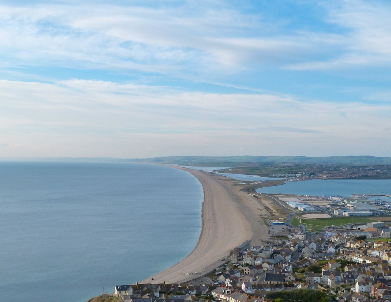
The Chesil Beach, or Chesil Bank, is a dramatic 18-mile curve of steeply banked shingle stretching north-west from Portland (the southern-most point of Dorset) to West Bay via Abbotsbury. The formation contains a long tidal lagoon known as the Fleet.* 

Portland Bill & Chesil Beach (Landsat)

Before a causeway road was constructed, the bank connected the mainland to the Isle of Portland, creating a form of TOMBOLO (strictly, it is a ‘barrier beach’). The uninterrupted shingle strip of Chesil beach is up to 50 feet high in places. The stones are large at the Portland end, gradually reducing in size until, by the western end at West Bay, they are pea-sized. It is said that in the past (and maybe still) local people were able to tell the location on the beach that a particular pebble had come from. This knowledge was supposedly helpful for the accurate landing of contraband at dead of night, smuggling being a popular occupation along the Dorset coast (and maybe still).

Chesil Beach, the Fleet and the Isle of Portland, from the north-west over AbbotsburyWiki

Chesil Beach looking north-west from a viewpoint on PortlandChesil Bank 1

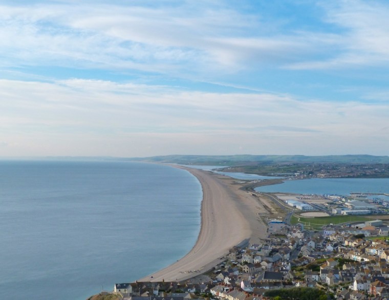
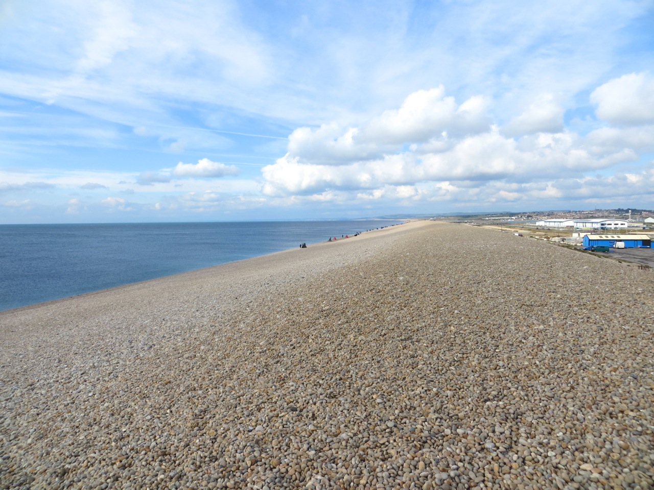
A long shot of the same view, showing the Fleet  lagoonChesil Bank 2

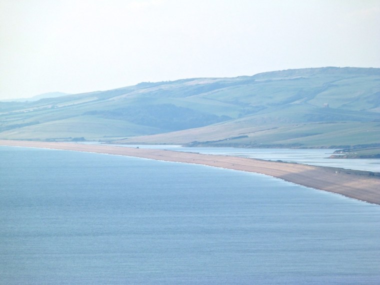
Boats on top of the beach at PortlandChesil Bank 15

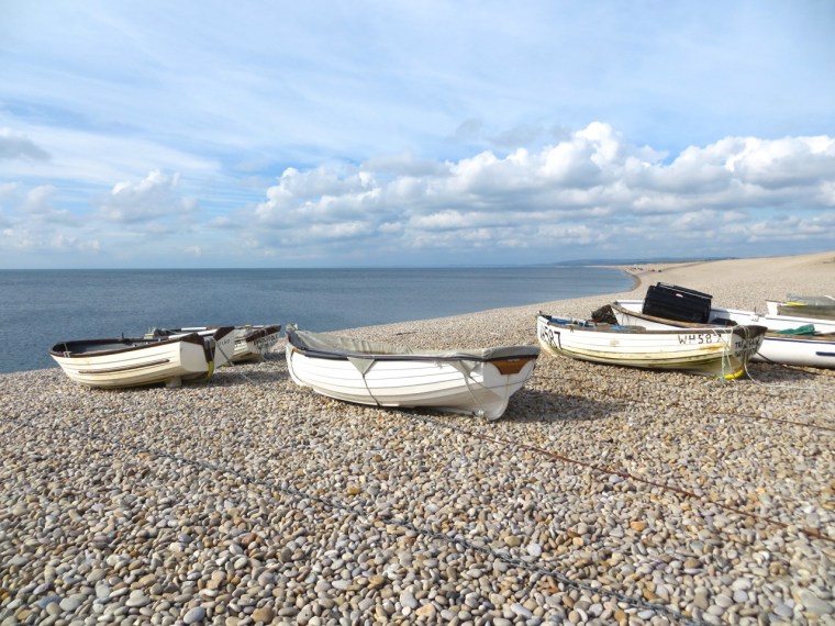
This view shows the breadth of the beach at the Portland end – solid shingle throughoutChesil Bank 4

Further along, fishermen line up all along the water’s edgeChesil Bank 5

The rake of the beach on the seaward side. It’s much steeper on the landward side.Chesil Bank 6

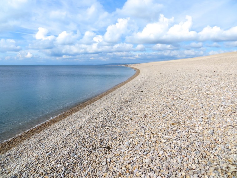
We sat on a tide-shelf above the waterline – the top stones bone dry, the next layer down wet.Chesil Bank 12

Everyone will be familiar with the gentle swoosh sound of small shingle as the waves come and go. On Chesil Beach, the wave interaction with the large pebbles produces a remarkable clattering and clacking sound that is mesmerising to listen to. Luckily I remembered the video button on my camera, so here’s a very short movie to demonstrate this.

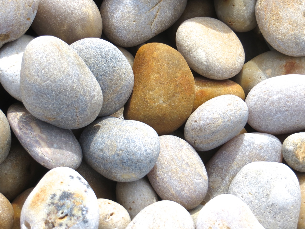
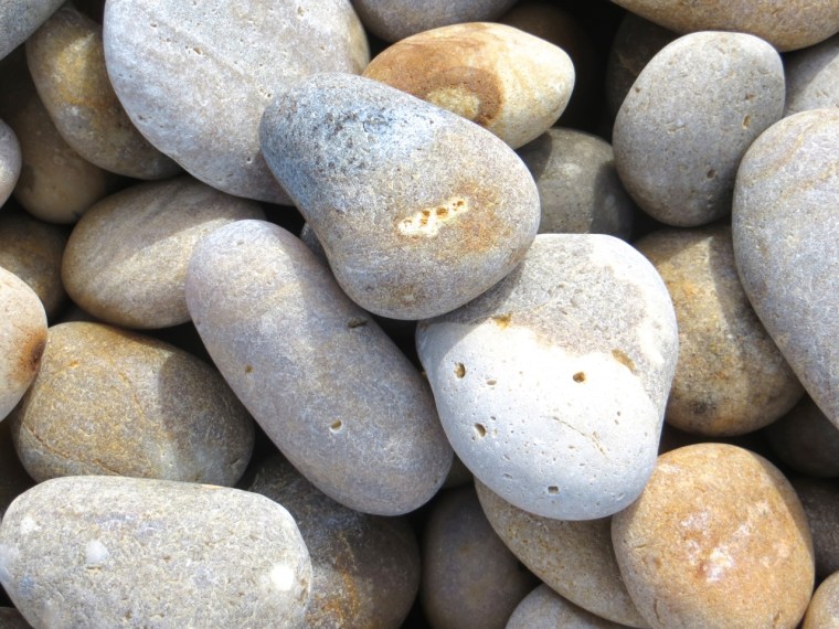
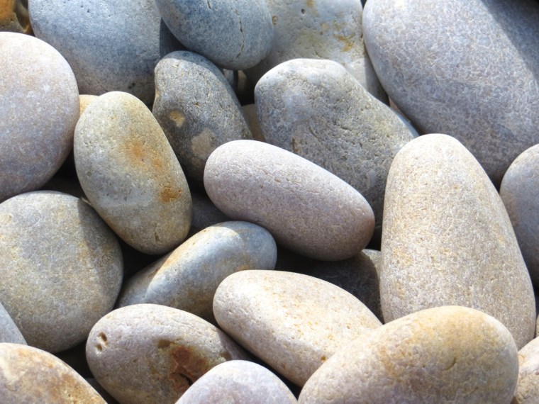
Here is a collection of photos of the stones around us as we sat by the sea. The apparently uniform colouring of the beach from a distance turns out to be a blend of many soft, subtle colours and shades – not least because the stones are of different materials. The geology of the beach would make a good post for another occasion, but not by me!

Chesil Bank 13Chesil Bank 10 
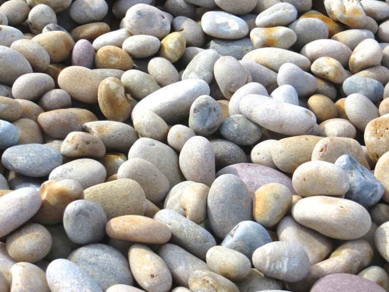
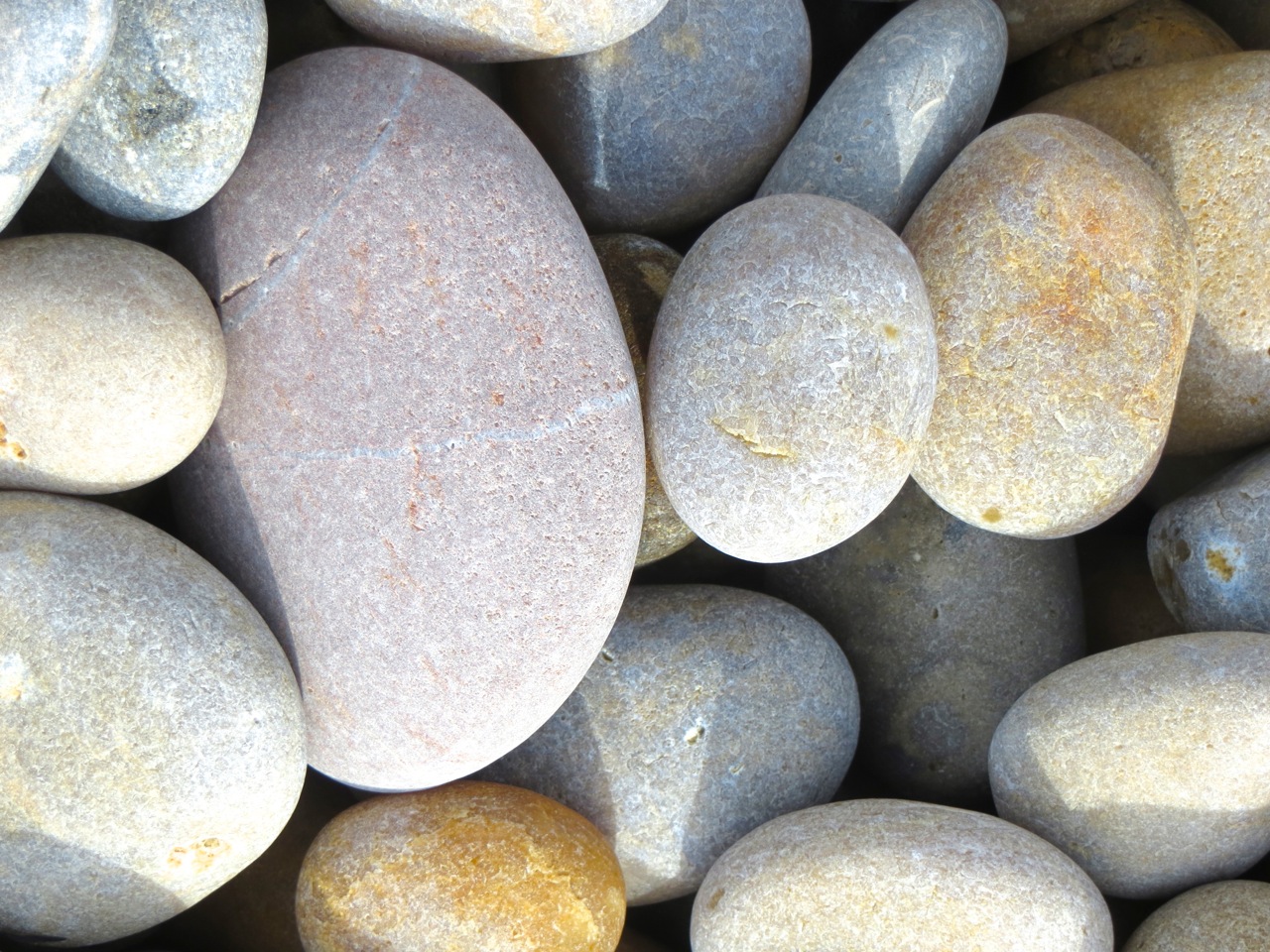
Close-up of the bottom left corner aboveChesil Bank 11Chesil Bank 7 Chesil Bank 8 Chesil Bank 9 Chesil Bank 14

Finally, a reminder of the area’s more turbulent past – a time of press-gangs, blackjacks and daggers swiftly drawn in candlelit taverns. A portland stone plaque in the Church of St George, Portland gives eloquent testimony to an era of lawlessness.Press Gang Memorial, Portland

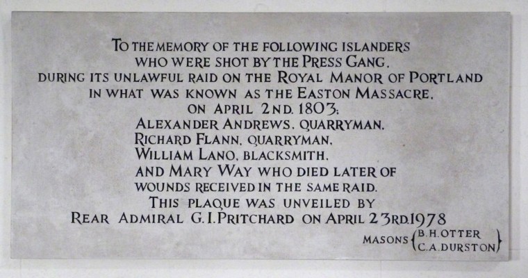
Later, and perhaps in consequence, Portland became the centre of the Knuckleduster-making industry that flourished on the island until the passing of the Prevention of Crime Act 1953, which defined and prohibited “the carrying of offensive weapons without lawful authority or reasonable excuse”. The industry, already in sharp decline in the 1930s, was by then nearly defunct, with only one craftsman still active on Portland. In 2012, a large and elegant sculpture to commemorate this unusual aspect of Portland’s history was installed in a prominent position, commanding a fine view over the the Chesil Beach to Weymouth and the mainland beyond.

Chesil Bank 3The ‘Knuckleduster Memorial’ also marked Weymouth & Portland as the Olympic Sailing venue

* I’m reluctant to endorse the enthusiastic marketing of large swathes of the Dorset seaboard as ‘The Jurassic Coast’. There are fossils in many places. They are fun to look for. More fun to find. Best not to turn it into a Theme Park. I’ll leave it at that.

CABBAGE WHITE BUTTERFLIES DESERVE A CLOSER LOOK?


These cabbage whites – a name redolent with faint scorn (contrast Purple Emperor, Red Admiral, Peacock etc) – were out and about on a warm Dorset July day. They couldn’t actually get at the cabbages / purple sprouting broccoli, where they no doubt would have liked to lay their eggs – too well covered over. So I decided to see if they merited a photo-shoot in their own lepidopteran right. I think close-to they have their own beauty.Cabbage White ButterflyCabbage White Butterfly on lavenderCabbage White Butterfly DetailCabbage White Buttefly feeding on lavenderCabbage White Butterfly feeding on lavender

I’m often surprised how ragged the wings of a butterfly can get, without its flight being affected. I guess it is the sign of impending doom though, a rather sad thought…Cabbage White Butterfly - Dorset

HELSINKI FOOD MARKETS


Helsinki Food Markets 2Helsinki Food Markets 1Helsinki Food Markets 3 Helsinki Food Markets 4 Helsinki Food Markets 5 Helsinki Food Markets 6 Helsinki Food Markets 7 Helsinki Food Markets 8 Helsinki Food Markets 9 Helsinki Food Markets 10

ROCK BEAUTY Holacanthus tricolor


Rock Beauty Desktop WP clip

WANT TO FIND OUT MORE ABOUT THIS REEF FISH SPECIES? CLICK HERE