TRIG POINTS AS THE FOCUS FOR A DORSET WALK


Batcombe in the heart of Dorset is a hamlet of farms, cottages, and a tiny medieval church with a fine stone screen. It is also the name of the long hill that rises steeply above it, which we see from our house. This is green Hardy country. The sinister ‘Cross in Hand’ mentioned in Tess is still there, a small battered stone pillar by the roadside now protected by a neat council fence. The fields have mostly been cleared of flints, on the surface at least. There are three trig points across the length of the hill. The advantage of Trigs is that their tendency to be on high ground often goes with nice countryside and scenery.  The middle one on Batcombe is a perfect focus for an easy country walk with huge views in 3 directions, especially south towards Hardy’s Monument and the coast. Time to explore.Batcombe Map 1 jpg Batcombe Map 2 jpg

TRIG POINT S1513, BATCOMBE, DORSET

Batcombe Trig Point walk 4Batcombe Trig Point walk 3Batcombe Trig Point walk 2Batcombe Trig Point walk 1

Looking back towards the Trig Point down the ‘tractor avenue’Batcombe Trig Point walk 5Batcombe Trig Point walk 6Batcombe Trig Point walk 7

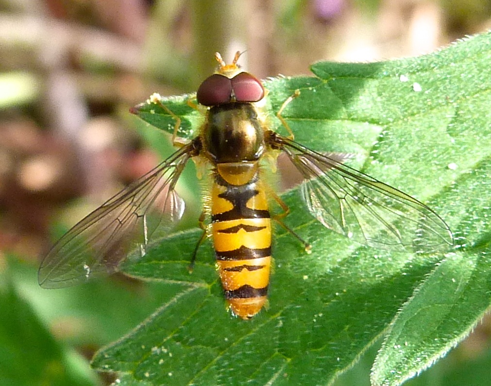
This was one of the few sunny days in February and the ground was firm and dry despite the appalling rain that had flooded the lower land and swathes of the Dorset valleys, e.g. those of the Yeo, Frome and Stour. Every 20 metres or so we put up snipe that were invisible amid the stubble and stones on the ground. We were accompanied throughout by a throng of skylarks. These were annoyingly hard to photograph  both on the ground (hard to see) and in the air. Here’s an effort.Batcombe Trig Point walk 8

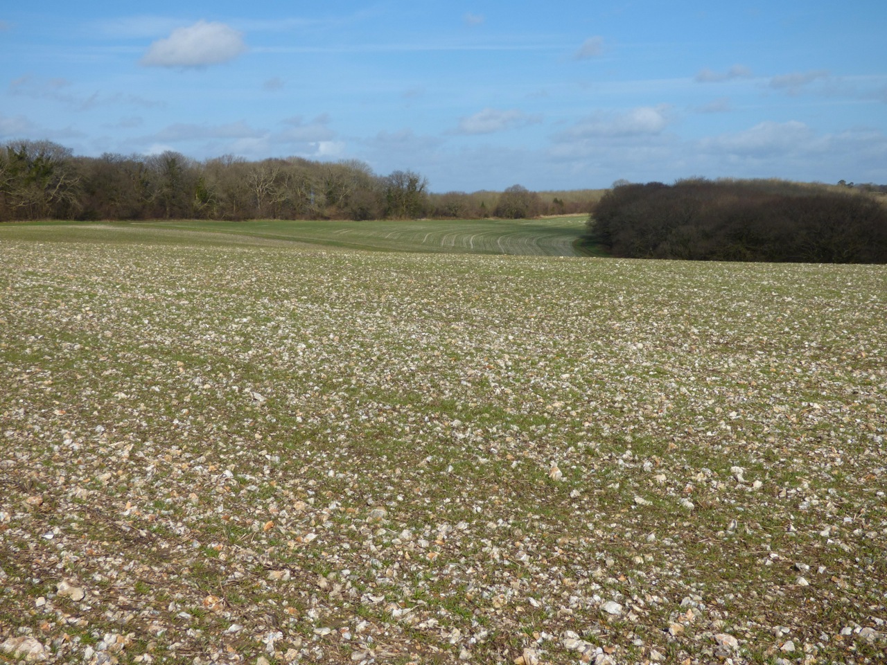
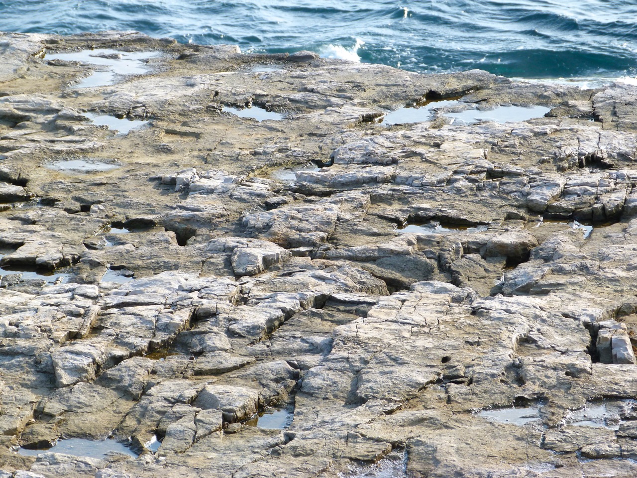
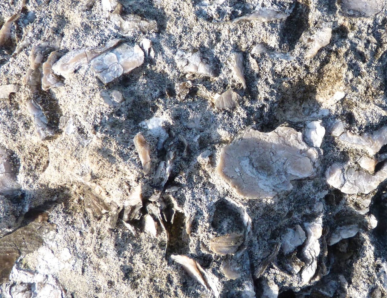
Some fields were very flinty, with some surprisingly large chunks. Despite the sunshine, it was easy to image poor Tess (or any other Hardy tragic heroine) shivering out in these fields in terrible winter winds and sleet, clad only in a thin kirtlet and shawl, picking the stones bare-handed and putting them in the thracking stoop for transportation as building material to the expanding Casterbridge.
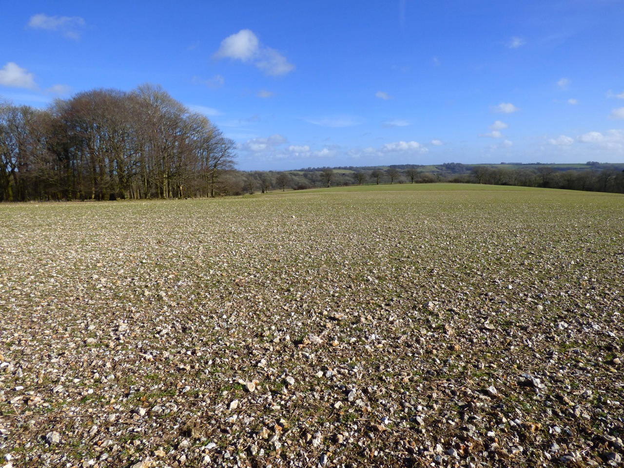
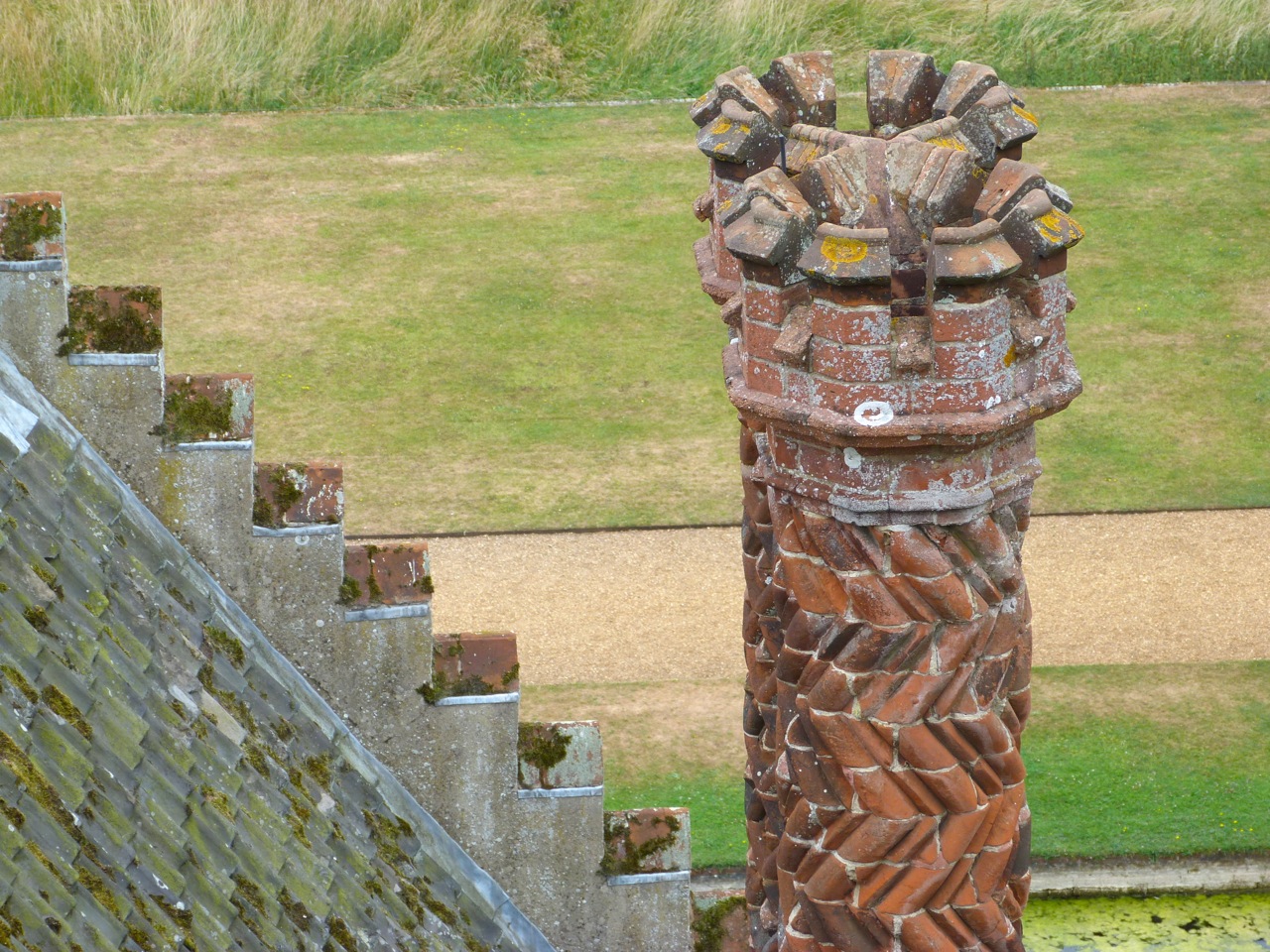
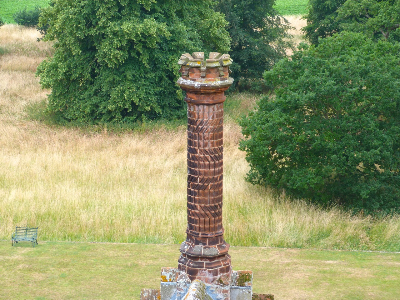
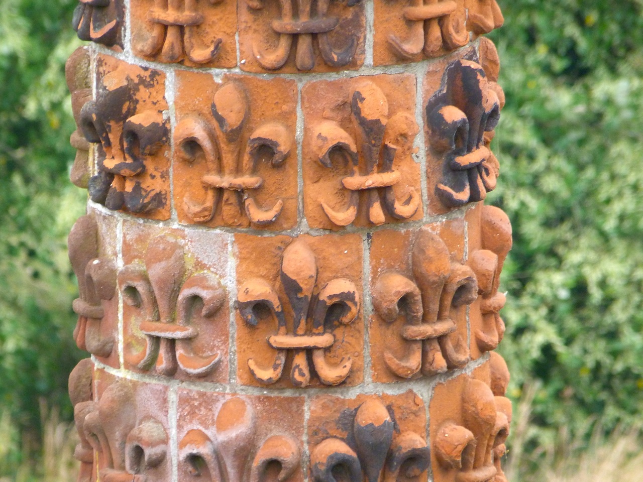
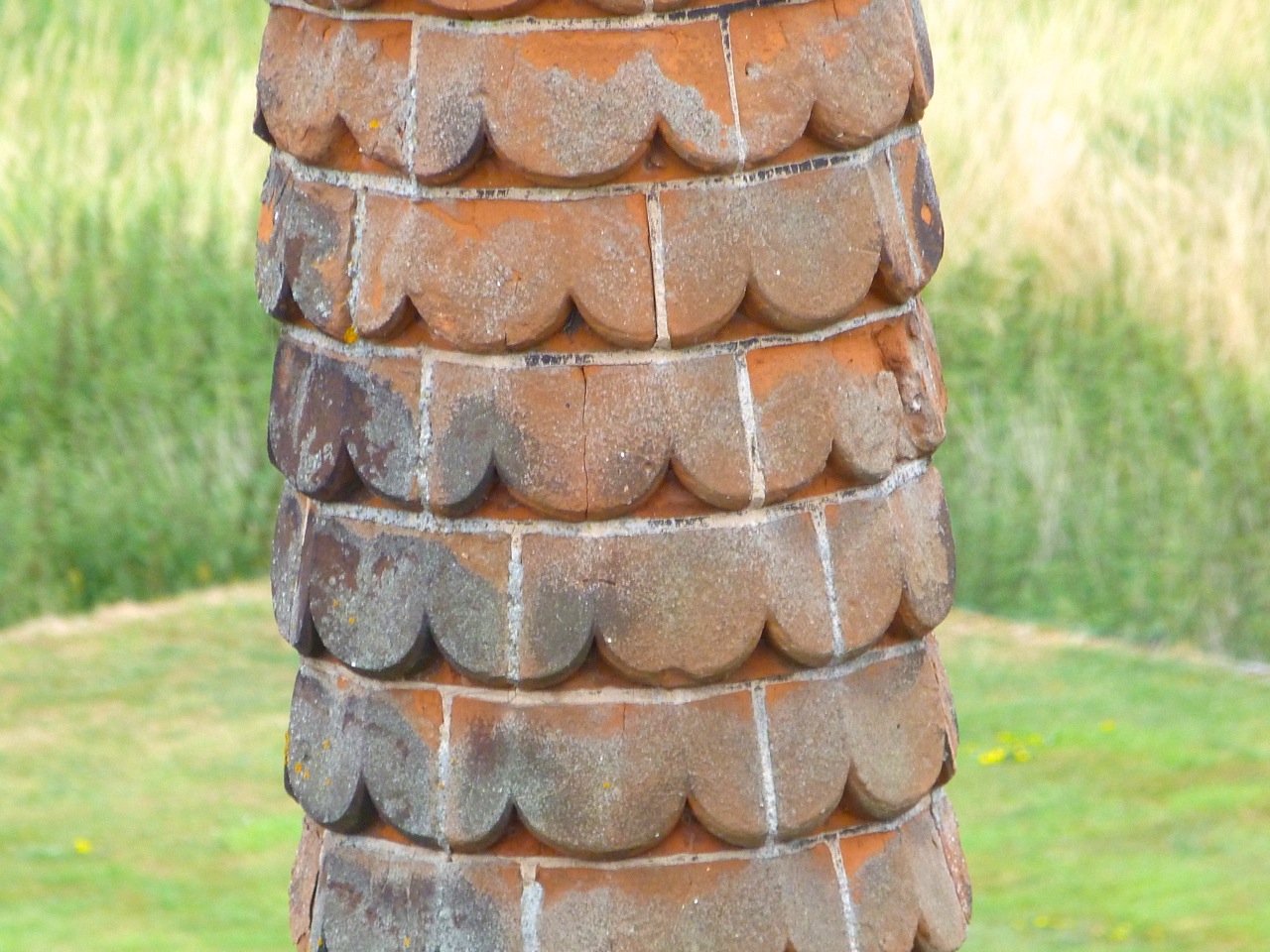
Batcombe Trig Point walk 9Batcombe Trig Point walk 10Batcombe Trig Point walk 11Batcombe Trig Point walk 12

A JELLYFISH IN OXFORDSHIRE: GOOGLE SURPRISES


There are various websites revealing the weird and wonderful oddities thrown up by the Google mapping projects. Google ‘Google Map Fail’ or ‘Google Streetview Fail’ for examples, including the location of Tessa Jowell inside the Houses of Parliament, complete with directions for reaching ‘Tony Blair’ in the time of 4 hours 40 mins. tumblr_l5i5rzwhj31qa0hs6o1_500The aerial mapping project has similarly revealed amazing vast drawings in remote desert regions, viewable only from the air; jet fighters laid up in municipal car parks; and Coca Cola logos in surprising places. By chance, I found one of my own when I was looking at the topography of the Oxfordshire / Wiltshire border.

Something of interest in a field close to Ashbury?Screen Shot 2013-12-30 at 20.59.36

Zoom in – what on earth is that in the field near top centre?Ashbury 4

Mmmmm. Looks familiar, but out of place…
Screen Shot 2013-12-30 at 20.59.52

Good grief – aliens have been at work…
Screen Shot 2013-12-30 at 21.00.07

…and they plainly know all about undersea creatures on EarthAshdown jellyfish

“COMING IN TO LAND…” AERIAL LONDON


It’s always interesting to get a new viewpoint of a city, for example London. A plane is perfect for that, except that planes bound for Heathrow are generally flying too high for anyone to do more than spot the general layout and the main landmarks. Photos are unlikely to be worth bothering with, even if your have a window seat. However, London City Airport offers more opportunity. Flying in last week, I realised it might be worth getting the iPhone out to see what I could do with it through the mist and cloud. The answer was, take rather poor pictures. Then I thought about turning them black and white. Suddenly they took on a new look, both old-fashioned and rather intriguing. I thought so anyway, so here they are. 

THE SHARDLondon aerial 1 London aerial 2 London aerial 3

TOWER BRIDGE with CITY HALL

London aerial 4

THE THAMES & DOCKLANDS

London aerial 5 London aerial 8London aerial 7

THE HSBC BUILDING (CITY MELTDOWN…)

London aerial 6

MILENNIUM DOME

London aerial 9

THAMES BARRIER

London aerial 10

AN ANCIENT LIGHTHOUSE, A TRIG POINT & A FINE VIEW: ST CATHERINE’S DOWN, IoW


St Catherine's Hill Trig Point IoW 1

St. Catherine’s Down is a chalk down near the southernmost point of the Isle of Wight, rising to 240 metres above the level of the nearby sea. There is a rewarding walk from a car park on the road, climbing steadily and in places quite steeply. On the way up there are spectacular views across to the Needles to the west.

St Catherine's Hill Trig Point IoW 8

Eventually the track opens out near the top of the hill to reveal an amazing medieval  prototype for a skyrocket near the summit. St Catherine's Lighthouse, Niton IoW 1

This is in fact St. Catherine’s Oratory, known locally as the ‘Pepperpot’, a stone lighthouse built in the 14th century by Walter de Godeton. It is the second oldest lighthouse in the British Isles – only the Roman-built lighthouse at Dover is older.St Catherine's Lighthouse, Niton IoW 2

De Godeton was convicted of scavenging wine ‘belonging to the Church’ from a shipwreck. He was ordered to make amends, under threat of excommunication, by building a lighthouse. Wreck plunder / lighthouse penance – a rare early example of punishment fitting the crime at a time when theft of a sheep might mean death. Fires were lit in the lighthouse tower to warn ships at sea that they were close to the coastline.St Catherine's Lighthouse, Niton IoW 3

There was an attached chapel at one time – hence the ‘Oratory’ – but it has been long since demolished. A replacement lighthouse was begun in 1785, but never completed. Locally this half-finished building is known as the ‘salt pot’.St Catherine's Lighthouse, Niton IoW 4

The hill is surrounded by unspoilt downland, with long views on all sidesSt Catherine's Hill Trig Point IoW 2St Catherine's Hill Trig Point IoW 3

St Catherine's Hill Trig Point IoW 9

There is also a trig point, providing an  unstrenuous target for ‘trig-baggers’. Anyone interested in using trig points as a purpose for a nice walk and needing an incentive for the achievement might like to look at http://www.trigpointinguk.comSt Catherine's Hill Trig Point IoW 6St Catherine's Hill Trig Point IoW 7St Catherine's Hill Trig Point IoW 5St Catherine's Hill Trig Point IoW 4

PORTLAND BILL, DORSET – ROCKS & FOSSILS 1


Pulpit Rock is an artificial stack of rocks at the southern tip of Portland. It was created in the 1870s during quarrying as a relic of the industry. It is climbable and is apparently somewhere that the adventurous like to ‘Tombstone’, an activity beyond my imagining.

PULPIT ROCKPortland Bill, Dorset - Pulpit Rock

The flaggy flat areas near the rock are reminiscent of the ‘Flaggy Shore’ of the Burren, Co. ClarePortland Bill, Dorset - Rocks & Fossils 2Portland Bill, Dorset - Rocks & Fossils

Rock. And a pretty wheatear. There were also meadow pipits, and lots of gulls Portland Bill, Dorset - Rocks & Fossils 3

The rock surfaces all round Pulpit Rock is known as ‘Snail Shore’, embedded with millions of snail, oyster and mollusc shells from what was once the seabed in Jurassic times. Here are a few examples, some surpassingly large.Portland Bill, Dorset - Rocks & Fossils 4 Portland Bill, Dorset - Rocks & Fossils 5 Portland Bill, Dorset - Rocks & Fossils 6 Portland Bill, Dorset - Rocks & Fossils 7 Portland Bill, Dorset - Rocks & Fossils 8

An arty shot of Pulpit Rock to end with, taken into the sun with mixed successPortland Bill, Dorset - Pulpit Rock 2

PORTLAND, DORSET (1) THE LIGHTHOUSE AT PORTLAND BILL


Portland is a ‘tied  island’ at the southernmost point of Dorset, linked to the mainland by a 5 mile strip of steeply banked stones and pebbles called the Chesil Beach (or to the older among us, Chesil Bank) that runs northwest towards Abbotsbury and West Bay. There is now a road, of course. The bank’s formation is known as a ‘tombolo’, where a spit joins to land at both ends,  creating a tied island and often a lagoon (here known as the Fleet).

Portland MapPortland Lighthouse 2

I’ll be posting about Chesil Beach and other aspects of Portland in due course. Meanwhile, I’ll focus on the southern tip of Portland, known as Portland Bill. There are 3 lighthouses there. Two were operationally replaced in 1906 by a classic red-and-white striped edifice, and are now, respectively, holiday apartments; and a bird observatory. The ‘new’ lighthouse stands guard over a strong tidal race caused by the underwater continuation of the Portland rock ‘shelf’ and the Shambles sandbank further offshore. 

Portland Lighthouse 3The LanternPortland Lighthouse 4

Portland is one of the ‘Sea Areas’ familiar from UK shipping forecasts, located between Wight and Plymouth. The lighthouse, 115 ft high, is a prominent navigational landmark for the English Channel.

Portland Lighthouse 1

Since 1514, Trinity House has been the organisation with responsibility for lighthouses and the safety of UK shipping generally since the grant of a Royal Charter by Henry VIII. The Portland light bears the Trinity House arms.

Portland Lighthouse 6

It also bears a substantial foghorn, essential to warn of the coastal rocks as well as the strong current from the tidal race

Portland Lighthouse 5

As ships are warned by the foghorn, so humans are warned of the foghorn…Portland Lighthouse 7

At the cliff edge is a stout obelisk of portland stone erected by Trinity House in 1844 (before the present lighthouse existed) as a daylight warning to passing ships of the dangers of the offshore race.

Portland Lighthouse 8 Portland Lighthouse 9

DARTMOOR ROCK WALL STUDIES: MOSS & LICHEN


The images below come from one small section of rock wall in a remote part of Dartmoor. Every rock shown touched at least one of the others, yet the variety of rock composition, mosses and lichens over one area of wall is astounding.

Dartmoor Rock Wall 1 Dartmoor Rock Wall 2 Dartmoor Rock Wall 3 Dartmoor Rock Wall 4 Dartmoor Rock Wall 5 Dartmoor Rock Wall 6 Dartmoor Rock Wall 7 Dartmoor Rock Wall 8 Dartmoor Rock Wall 9 Dartmoor Rock Wall 10 Dartmoor Rock Wall 11

SUNDIALS AT HOUGHTON HALL, NORFOLK


On a recent trip to Houghton for an exhibition, I forgetfully left my camera in the car. Suddenly we were confronted by a fine ornate C18 pillar or column sundial, fit for one of the marginally better-curated theme pages of this sub-blog, SUNDIALS. Resorting to an iPh*ne in low light was far from ideal, so apologies for the quality of the images. Fortunately you can see the ingenious ways in which the 4 gnomons are attached to achieve the correct shadow angles; and the numbering variations of the faces, depending on their orientation. The result is dawn-to-dusk time-telling. Always provided the sun is shining!

1.  A FOUR-SIDED C18 PILLAR  SUNDIAL IN THE GARDENS AT HOUGHTON

IMG_0168  IMG_0169 IMG_0170 IMG_0172 IMG_0173

2. A FOUR-FACED SUNDIAL ON AN OCTAGONAL TOWER: HOUGHTON HALL, WEST FRONT

By the time we got to the house a light drizzle was falling and there was no hope of a decent photo. I’ve had to borrow, as credited. I’ve included 1 poor effort at the end simply to give the sundial’s context in relation to the house. Thanks to Elliott Brown for use permission for the first two. You can see these and his other images HERE. Again, you can clearly see the variations in the gnomon placement; and in the numbering / angling of the faces. And, thankfully, proof that the sun does shine in  Norfolk.

Houghton Hall Sundial EB grab 1Houghton Hall Sundial EB grab 2

The image below is credited to Edmund Patrick and licensed via wikimedia commonsHoughton Hall Norfolk 4-face sundial Edmund Patrick wikimedia commons

Bad weather shot… in all senses
IMG_0176

A STACK OF CHIMNEYS AT OXBURGH HALL, NORFOLK


Terracotta Chimneys, Oxburgh Hall, Norfolk 1The medieval core of Oxburgh Hall dates from 1482. In the Victorian era, a number of features were added, including oriel windows overlooking the moat (see above), crow- (‘flemish’) stepped gables and a number of tall terracotta chimneys, all  differently patterned. Here are some of them.

1482Oxburgh Hall Date Terracotta Chimneys, Oxburgh Hall, Norfolk 2Terracotta Chimneys, Oxburgh Hall, Norfolk 3Terracotta Chimneys, Oxburgh Hall, Norfolk 5 Terracotta Chimneys, Oxburgh Hall, Norfolk 6 Terracotta Chimneys, Oxburgh Hall, Norfolk 7 Terracotta Chimneys, Oxburgh Hall, Norfolk 8 Terracotta Chimneys, Oxburgh Hall, Norfolk 9 Terracotta Chimneys, Oxburgh Hall, Norfolk 10 Terracotta Chimneys, Oxburgh Hall, Norfolk 11 Terracotta Chimneys, Oxburgh Hall, Norfolk 12

DORSET BEES, WILD HONEY & A RED SUNSET


GETTING TO GRIPS WITH A CANTERBURY BELLDorest Bees July 13 1

IF THE CAP FITS…Dorest Bees July 13 2

WHAT ARE THESE ‘HOVER-WASP’ GUYS CALLED?Dorest Bees July 13 3 Dorest Bees July 13I only noticed the gleaming gold thorax after downloading the photos

WILD BEES IN A WOODPECKER NEST BOX, ABACO, BAHAMASDelphi Wild Bees 2 Delphi Wild Bees 1

This year we had West Indian Woodpeckers using 2 nest boxes under the eaves.This successfully diverts them from drilling into the woodwork of the building. They raised two families this season, with 3 chicks fledging each time. Another nest box on a tree in the drive was not to their liking, and was quickly colonised by wild bees. The nearest small apiary – there are only two I know of on an island 120 miles long – is 15 miles away. These bees will never have known the luxury of a hive. I doubt they’d need or want it…

I photographed this sunset from our garden in Dorset a couple of evenings ago. In reality it was more dark pink than red, but by simply zooming directly at it the colour was altered dramatically. The second image is a simple crop of another photo taken seconds later, as the banding became clearer as the sun sunk below the horizon. It looks more like a planet. [NB No P/shop]
Dorset Sunset July 2 Dorset Sunset July 13