FACE TO FACE WITH BEES: MORE AMAZING MACROS


Following up my last bee post, here are some more amazing macro shots of bees  from Sam Droege and the USGS Bee Inventory and Monitoring Lab. This time, it’s up close and personal… 

Macro photograph of bee #11 Macro photograph of bee #13 Macro photograph of bee #14 Macro photograph of bee #6 Macro photograph of bee #9

This is in fact a jumping spider, but I just couldn’t leave it out…Macro photograph of spider All photographs: Sam Droege and the USGS Bee Inventory and Monitoring Lab 

BEES IN FLIGHT: AMAZING MACROS


My general rule is to try to stick to posting my own photos, with occasional illustrative borrows. But rules are made to be broken, and sometimes images that are so astounding that they are irresistible are made available online. The Guardian website showed some bees from the USGS Bee Inventory and Monitoring Lab that are compelling… here are a few ‘in flight’, from their massive reference library of bee species. If you hover over each image, you’ll get the ID and location of the bee.

A female Augochloropsis metallica bee, collected from a tomato plant in San Francisco. A female Halictus ligatus bee, from the Morris Arboretum of the University of Pennsylvania A male Euglossa dilemma bee from Biscayne National Park A female Anthophora affabilis bee from Badlands National Park, South Dakota A female Andrena erythronii bee A female Eucera rosae bee from Queen Anne's County, Maryland A male Bombus bimaculatus bee from Wolf Trap National Park A Megachile fortis bee from Badlands National Park, South Dakota A female Centris species bee from the Dominican Republic

All photographs: Sam Droege and the USGS Bee Inventory and Monitoring Lab 

PEAT WORKINGS, COUNTY MAYO


Between Louisburgh, Co. Mayo and Killary Harbour to the south – the boundary with Galway – is a fertile plain. This gives way to an area of wonderful high mountains and loughs, and some of the best salmon fishing in Ireland. The plain is drained by rivers, and is the perfect location for one of Ireland’s great natural resources: PEAT.

Peat Country, Co. Mayo

The backdrop to the north includes the spectacular conical pilgrimage mountain CROAGH PATRICK, rising more than 2,500 feet almost directly out of the sea. Peat workings can be seen from the main road south, but they are best viewed by taking a side road through boggy countryside to the more remote areas.

Peat Country, Louisburgh, Co Mayo 1Peat Country, Louisburgh, Co Mayo 6Peat Country, Louisburgh, Co Mayo 2Peat Country, Louisburgh, Co Mayo 5

In places the cut turf is stacked like old-fashioned corn stooks,  in gently curving rows. The effect is of some organic work that the sculptor ANTONY GORMLEY might have dreamed up.

Peat Country, Louisburgh, Co Mayo 4 Peat Country, Louisburgh, Co Mayo 3

RUS IN URBE: A REDWING VISITS LONDON


We don’t often see redwings in our garden on the western edge of central London. It is not their natural territory.  Occasionally when mid-winter weather has been very cold, with frost-hardened ground, they will venture to the city for food. Two days ago I was watching a pair of blackbirds apparently courting in a tree at the end of the garden, when 5 redwings landed in the branches beside them. By the time I had found my camera and returned to the window, only one redwing remained. I fired off some shots rather hopefully through the glass, before the bird flew off…

Reddish underwing – checkRedwing, London 1

Speckled front and pale flash above the eye – checkRedwing, London 2

A bit of zoom to confirm the IDRedwing, London 3

We last had a redwing in the garden couple of years ago, during a prolonged frosty period. I was watching it on the lawn from an upstairs window when suddenly out of the air came a blur of speeding feathers followed by a loud squawk. A sparrowhawk had found its breakfast. I watched it eviscerate to redwing and feast on it for about 15 minutes. After it flew off, I examined the scene of the crime. All that remained of the redwing was a pathetic ring of feathers and its orange beak. The bones and even the feet had all gone. There was a sad little area of melted frost where the deed had been done. Here is a sequence of photos of the drama, mostly taken through glass in the early morning. Notice the growing ring of ripped out feathers as the corpse disappears…

Redwing & Sparrowhawk, London 2 Redwing & Sparrowhawk, London 3 Redwing & Sparrowhawk, London 4 Redwing & Sparrowhawk, London 5 Redwing & Sparrowhawk, London 6

CSI photograph showing the last remains of the victimRedwing & Sparrowhawk, London 1

A RIVER RUNS THROUGH IT… CERNE ABBAS, DORSET


Through and indeed under it, to be strictly accurate. This Dorset village, a few miles north of Dorchester, is well-known, but for (arguably) the wrong reason, the chalk-figure giant on the hill in all his unfeasibly impressive priapic  glory. Some say he represents Hercules (besides the fearsome club, excavations have found traces of some form of covering over the other hand – a manly lionskin for protection? Or for modesty perhaps?). Cerne Abbas, Dorset - The Cerne Giant 2

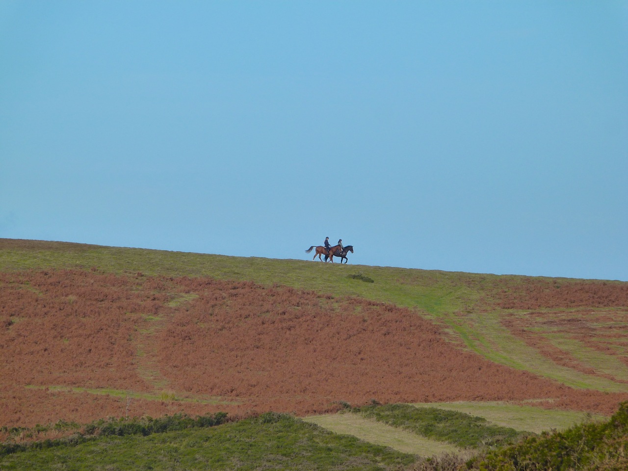
There are many theories for the giant’s origin and purpose, but the general consensus is that he dates from the c17 or early c18 – he is first noted in records in the mid-c18. Maybe he’s much older. It is said that a belief in the giant as a symbol of fertility encouraged young women of the surrounding area to climb the hill  and sit on his… oh, work it out for yourselves. Let’s move on swiftly.Cerne Abbas, Dorset - The Cerne Giant 3

The fairly recently installed car park overlooking the hill has information boards that are unusually helpful. There’s a good map of the village and its significant features, and another boards with details of the village and its history.Cerne MapCerne Abbas, Dorset - Information Board

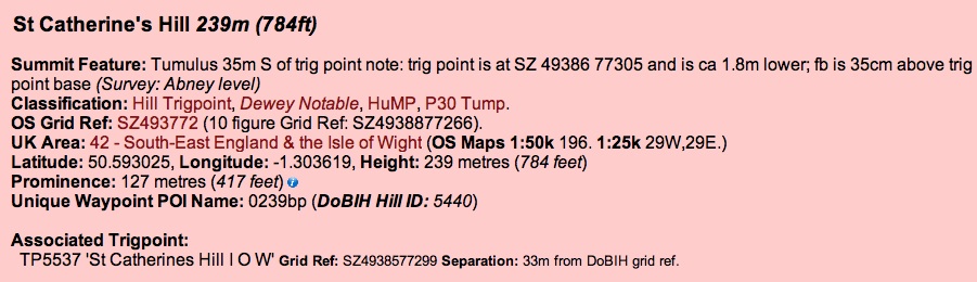
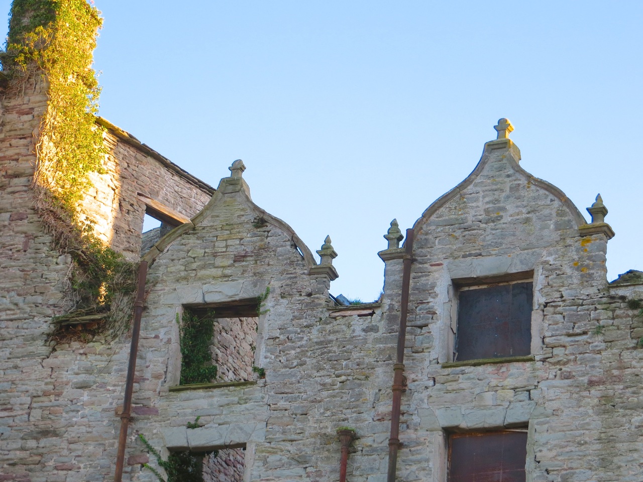
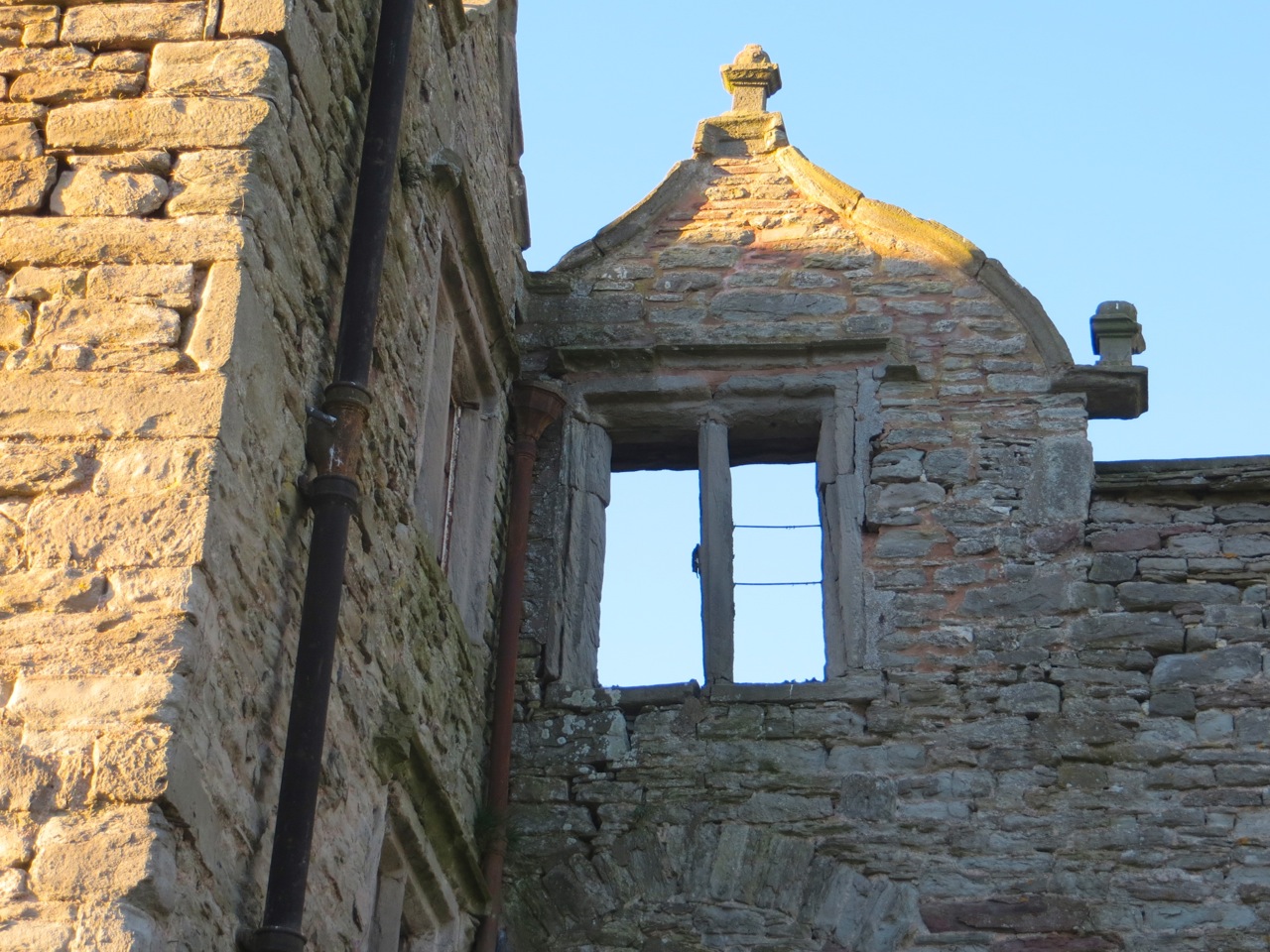
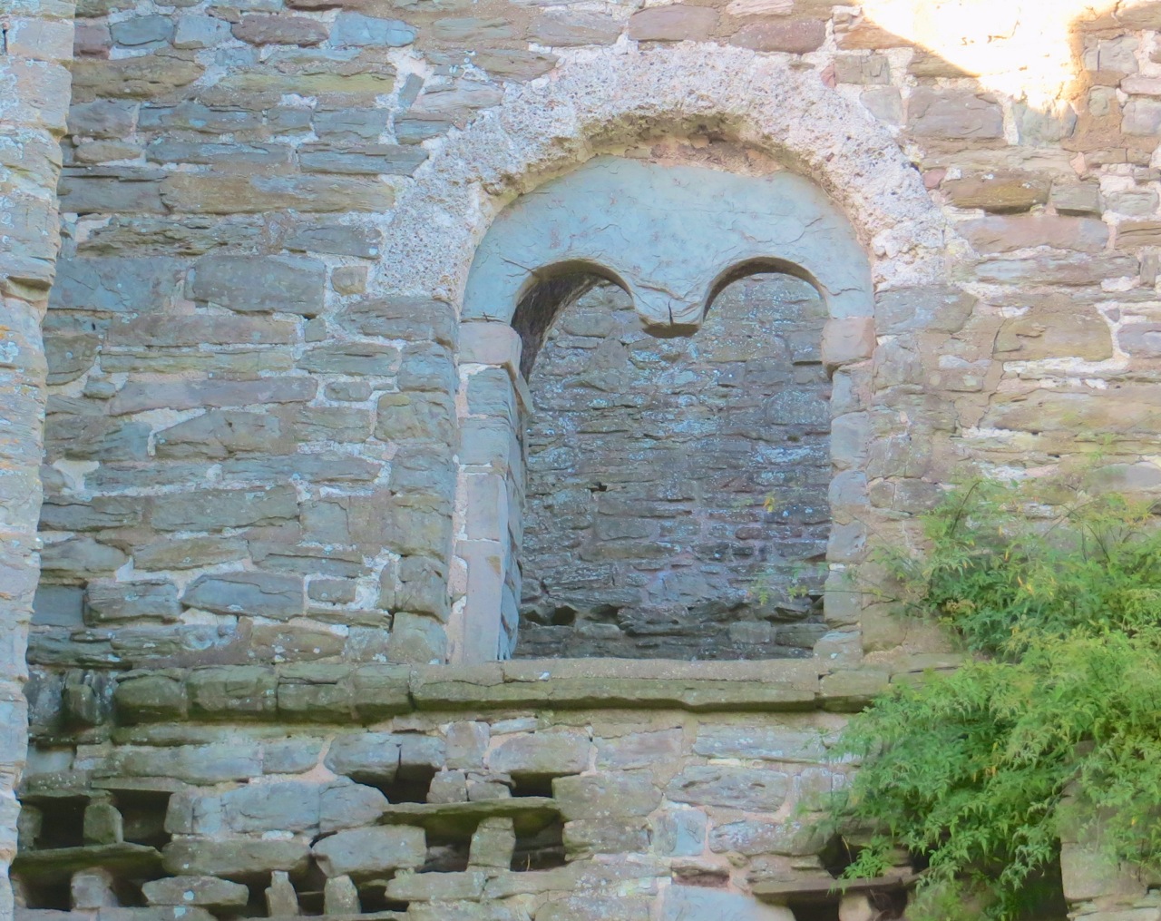
In AD 987 a Benedictine Abbey was founded below the giant’s hill. The dissolution of the monasteries erased it, and apart from a gateway (‘Abbot’s Porch) very little remains, though lumps and bumps in a field reveal its extent. Cerne Abbas, Dorset - The Abbey Ruins FieldCerne Abbas, Dorset - Abbey NoticeCerne Abbas, Dorset - Abbey Foundation Memorial

Medieval monasteries were invariably built close to a reliable source of fresh water. The River Cerne runs through the village, with rivulets running right under the main street. It is a trout stream, which doubtless provided food for the monks. However, there was another water source that still exists. St Augustine’s Well, replete with Augustinian legend.Cerne Abbas, Dorset - St Augustine's Well LegendCerne Abbas, Dorset - St Augustin's Well

The water constantly bubbles out of the ground, and has a remarkable clarity.  Although these leaves look as though they are on the surface, they are in fact covered by 3 inches of crystal-clear water.Cerne Abbas, Dorset - St Austine's Well 2

The water from the well runs a short distance to form a millpond, before joining the river.Cerne Abbas, Dorset - The Millpond

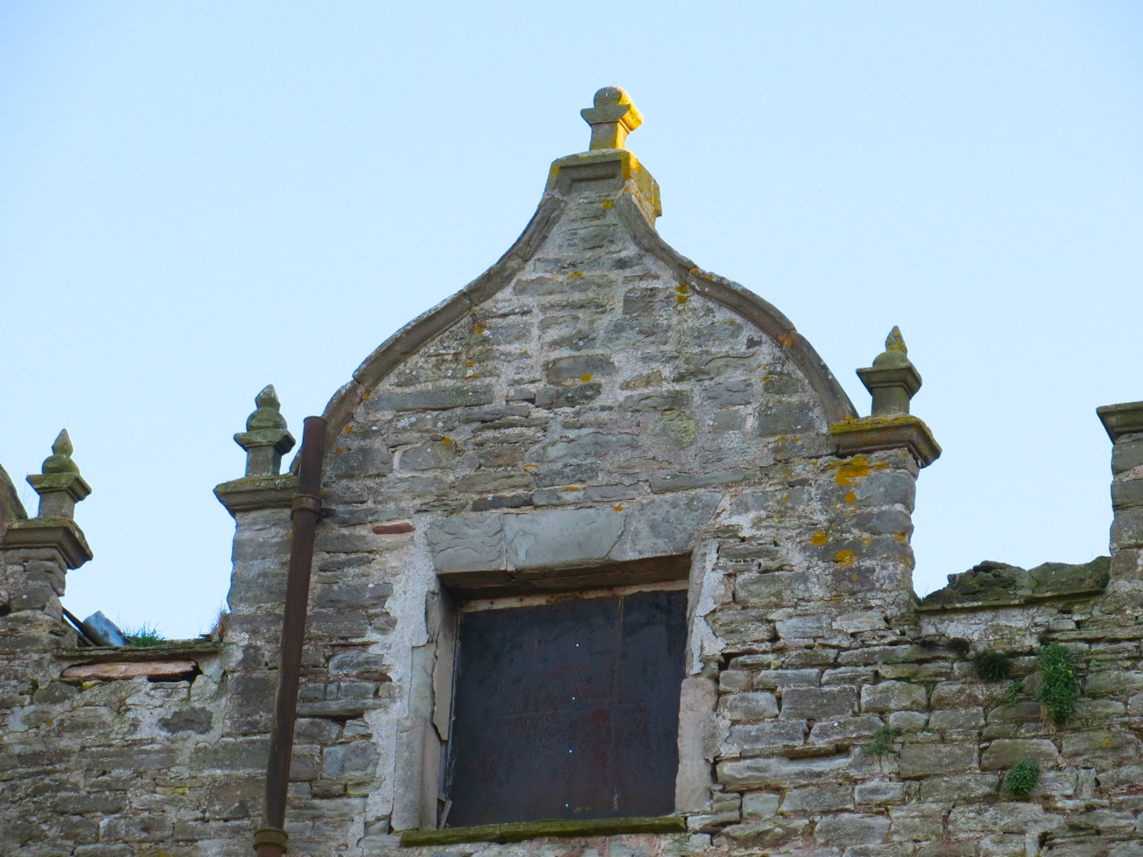
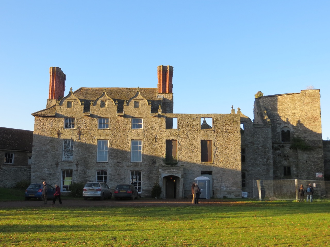
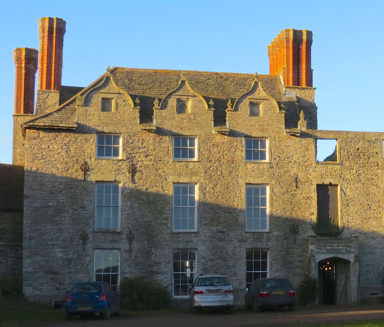
The manor house in its present incarnation dates from the 1750s, and is built in the abbey grounds Cerne Abbas, Dorset - Abbey House : Cerne Manor

The church of St Mary’s has a medieval origin, but was expanded in later centuriesCerne Abbas, Dorset - St Mary's Church  The churchyard is also in the abbey groundsCerne Abbas, Dorset - The Churchyard

Outside the church is a reminder of earlier  times for crime and punishmentCerne Abbas, Dorset - The StocksCerne Abbas, Dorset - Stocks

The Pitchmarket is one of the oldest buildings in the village, an excellent though spectacularly misshapen example of a Tudor building.Cerne Abbas, Dorset - Pitchmarket

Cerne Abbas, Dorset - The Pitchmarket

Cerne Abbas was the location of the 1963 film ‘Tom Jones’, starring Albert Finney and Susannah York. If you are interested in seeing stills from the film, showing the village ‘Fielding-ised’ for the film, click HERE. If you want to know more about the book, including a reasonable synopsis, click HERE

  A painted jest from a few years ago…

‘DUCKING & DIVING’: BUFFLEHEADS IN CENTRAL PARK NYC


The Bufflehead Bucephala albeola is a small American duck of the goldeneye family, named for the ‘buffalo’ shape of its head. These shots were taken on the JKO Reservoir in central Park NYC, at a bit of a distance. The ducks were mostly floating peacefully, with the occasional sudden splashy dive. When they surfaced, fat beads of water stayed on their backs. Unfortunately the light / position of the sun meant that I never caught one head on, when the purple and green sheen of the face feathers would be clearly visible. 

Bufflehead Duck Central Park NYC 1Bufflehead Duck Central Park NYC 4Bufflehead Duck Central Park NYC 3Bufflehead Duck Central Park NYC 5Bufflehead Duck Central Park NYC 6Bufflehead Duck Central Park NYC 7

HOODED MERGANSERS IN CENTRAL PARK, NYC


These hooded mergansers were on the JKO Reservoir in mid-Central Park, New York. The colourful male is shown first, then the less flamboyant female.

Hooded Merganser (m) NYC CP 3Hooded Merganser (m) NYC CP 2Hooded Merganser (m) NYC CP 1Hooded Merganser (f) NYC CP 2Hooded Merganser (f) NYC CP 3Hooded Merganser (f) NYC CP 1This bird has just surfaced from a dive, leaving her rather wet and dishevelled

AN ANCIENT LIGHTHOUSE, A TRIG POINT & A FINE VIEW: ST CATHERINE’S DOWN, IoW


St Catherine's Hill Trig Point IoW 1

St. Catherine’s Down is a chalk down near the southernmost point of the Isle of Wight, rising to 240 metres above the level of the nearby sea. There is a rewarding walk from a car park on the road, climbing steadily and in places quite steeply. On the way up there are spectacular views across to the Needles to the west.

St Catherine's Hill Trig Point IoW 8

Eventually the track opens out near the top of the hill to reveal an amazing medieval  prototype for a skyrocket near the summit. St Catherine's Lighthouse, Niton IoW 1

This is in fact St. Catherine’s Oratory, known locally as the ‘Pepperpot’, a stone lighthouse built in the 14th century by Walter de Godeton. It is the second oldest lighthouse in the British Isles – only the Roman-built lighthouse at Dover is older.St Catherine's Lighthouse, Niton IoW 2

De Godeton was convicted of scavenging wine ‘belonging to the Church’ from a shipwreck. He was ordered to make amends, under threat of excommunication, by building a lighthouse. Wreck plunder / lighthouse penance – a rare early example of punishment fitting the crime at a time when theft of a sheep might mean death. Fires were lit in the lighthouse tower to warn ships at sea that they were close to the coastline.St Catherine's Lighthouse, Niton IoW 3

There was an attached chapel at one time – hence the ‘Oratory’ – but it has been long since demolished. A replacement lighthouse was begun in 1785, but never completed. Locally this half-finished building is known as the ‘salt pot’.St Catherine's Lighthouse, Niton IoW 4

The hill is surrounded by unspoilt downland, with long views on all sidesSt Catherine's Hill Trig Point IoW 2St Catherine's Hill Trig Point IoW 3

St Catherine's Hill Trig Point IoW 9

There is also a trig point, providing an  unstrenuous target for ‘trig-baggers’. Anyone interested in using trig points as a purpose for a nice walk and needing an incentive for the achievement might like to look at http://www.trigpointinguk.comSt Catherine's Hill Trig Point IoW 6St Catherine's Hill Trig Point IoW 7St Catherine's Hill Trig Point IoW 5St Catherine's Hill Trig Point IoW 4

HAY CASTLE: ROMANTIC RUIN (c12th) & JACOBEAN RELIC (1660)


HAY CASTLE dominates the famous little book town of Hay-on-Wye, a fire-ravaged but stately part-ruin. Currently owned by the HAY CASTLE TRUST, a restoration project for this once-gracious building  is underway. I’d started to write my own potted history when it occurred to me that the official one would be (a) more informative and (b) more likely to be accurate. Here it is – click the blue link above for further information about the history and preservation of this important building.

“Hay Castle is one of the great medieval defence structures on the border of England and Wales still standing.  Built in the late 12th century by the powerful Norman Lord William de Braose, its history is long and turbulent.  The castle was sacked by Llewelyn II, the last prince of Wales, in 1233, and rebuilt by Henry III.  Centuries of turmoil followed until the 15th century, when the castle passed into the hands of the Beaufort Estates.  Castle House, a Jacobean mansion, was built alongside the tower in 1660.

The remains of the castle include a four-storey keep and a beautiful arched gateway.  The multi-gabled Jacobean manor was severely damaged by fire in 1939, and again in 1977.  Remnants of the 18th century formal gardens and 19th century terraced gardens can still be seen.  Owned by bibliophile Richard Booth since the 1960’s, the site was purchased in 2011 by the Hay Castle Trust.”

The summer Hay Book Festival is one of THE literary events of the year. Less well-known is the Hay Festival Winter Weekend. A Wales-related book published by Mrs Harbour was launched at the Castle, with an author’s talk and a party – followed by (and completely unconnected with) a gig containing copious humourous material of questionable taste by comedian Marcus Brigstocke. Here are a few photographs of the castle.

THE VIEW FROM THE TOWN SIDEHay Castle 1 Hay Castle 2 Hay Castle 3 Hay Castle 4 Hay Castle 5

THE CASTLE FROM THE GARDEN SIDE          Hay Castle 6Hay Castle 7Hay Castle 8 

A round-arched window dating back to an earlier period of the castle’s historyHay Castle 9Hay Castle 10

The only occupied part of the ruined side… a perfect place for birds to nestHay Castle 11

hay castle trustMrs RH takes the lectern 2                    "Powys" by Robert Scourfield

AN UNSTRENUOUS HILL WALK AT NEWCHURCH, POWYS


Newchurch Hill, Powys Map jpg

The area round Newchurch is a short distance north of the book Mecca that is Hay-on-Wye. Barely 15 minutes drive will take you to low hill country of moorland and open common, with fine views of the Black Mountains and, more distantly, the Brecon Beacons. We had book-related events to attend in Hay, and a remote farm B&B near Newchurch as base-camp. Behind it, Newchurch Hill and a Trig Point to ‘bag’ while the late November sun shone. 

Easy walking on open terrain, with plenty of sheep for companyNewchurch Hill Powys Walk 1

And horses. Most are wild, in that they are mainly  left to their own devices all year round. They are a mix of Welsh mountain ponies, Welsh cobs and perhaps some pit ponies, with other breeds adding to the genetic mix over the years. The greys are the purest bred.Newchurch Hill Powys Walk 2 Newchurch Hill Powys Walk 3 Newchurch Hill Powys Walk 4

There were a number of broad tracks, and because the land was so open the sheep tracks were very clearly defined. This one stretched a remarkably long way. You can just see our trig point target on the skylineNewchurch Hill Powys Walk 5

The trig point marks Newchurch Hill as 424 metres high, and provides extensive 360deg viewsNewchurch Hill Powys Walk 6 Newchurch Hill Powys Walk 7 Newchurch Hill Powys Walk 8

There are any number of ways to get to the top, and to return. This was a tempting track Newchurch Hill Powys Walk 9 Newchurch Hill Powys Walk 10

At one stage we were joined by a pair of red kites (the area is known as ‘red kite country’). It was gratifying to find that at one stage we were actually higher than they were. I wished I’d taken a bigger camera…Newchurch Hill Powys Walk 11 Newchurch Hill Powys Walk 12

As we walked down, a pair of riders from a nearby stables passed on the skyline Newchurch Hill Powys Walk 13

The stables had the perfect name for spelling out with horseshoes…Newchurch Hill Powys Walk 14